Showing posts with label pioneers. Show all posts

In the matter of Mrs Weston

A pioneering lady alpinist in late Meiji Japan

For Japanese alpinism, 1902 marked an epoch. In August, Kojima Usui climbed Yari-ga-take, a feat that led to the founding of the Japanese Alpine Club. And, in the same month, the geographer Yamasaki Naomasa found signs that these mountains had once been glaciated.

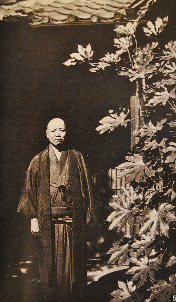
Frances and Walter Weston  

The year was no less epochal for Walter Weston (1860-1940). On April 3, the mountaineering missionary at last married - he was now well past his forty-first birthday. The bride was Frances Emily (1872-1937), the second daughter of Sir Francis Fox, a civil engineer.

At this time, Weston was between his first and second stays in Japan, serving as the priest in charge of Christ Church at Wimbledon in Surrey. Later in the same year, Mr and Mrs Weston would take ship for Yokohama, where they would both work for the Society for the Propagation of the Gospel.

Also propagated during this stay, which lasted until 1905, was quite a bit of mountaineering. The couple's alpine adventures were later written up in Weston's second book about Japan, The Playground of the Far East (1918) - which also covers the Westons' second stint in Japan (Walter Weston's third), from 1911 to 1915.

Mrs Weston soon made the acquaintance of Mt Fuji and its notoriously fickle weather. As her husband later recorded,

Early one July, my wife and I were not only imprisoned, at a height of 10,000 feet, by a storm which raged on the mountain for three days, but our coolies refused to go to the actual summit, and we had to finish the climb alone in the tail end of the typhoon … Now, on each occasion my wife has climbed Fuji with me such storms have been our lot .

Even greater excitement awaited the Westons at Kamikōchi, the gateway to what was then being rebranded as the "Japan Northern Alps". In those days, a herd of cattle belonging to the breeding farm of the Nagano Prefectural authorities used to graze the right bank of the Azusa river. It was here, one summer afternoon, that the Westons were confronted by an angry bull:

Suddenly, to our astonished gaze presented itself the form of this fierce monster planted firmly in the path no more than a dozen yards ahead. There he stood, waving his uplifted tail, pawing the ground, and shaking his huge, sharp horns with alarming and increasing energy… At the moment my wife happened to be in front of me … In answer to an agitated exclamation, "He's coming for me, what had I better do?" the only natural reply was, "You take cover to the right, and I'll go to the left," a manoeuvre no sooner suggested than executed .

Frustrated in his efforts to gore the Westons, the bull then chased good old Kamijō Kamonji into the middle of the river. Fortunately, the mishap did nothing to dampen the faithful guide's regard for his missionary client and friend.

Yari-sawa with Yari-ga-take in the background
As her sangfroid during the bull incident would suggest, Mrs Weston did not shrink from steep ground. A photo shows her taking part in a roped ascent of Yari-ga-take, the spire-shaped peak above Kamikōchi. Just as in Weston's first visit to Yari, two decades earlier, the party was guided by old Kamijō, this time accompanied by his son and Kamijō's dog. (Sorry, Hana, this hound may have scored the first canine ascent of the spire-shaped peak.)

Climbing Yari
In the summer of 1913, the Westons headed for Shirouma, a peak that had previously eluded him. By this time, modernity had reached the Northern Japanese Alps. Trains now ran where, on his first visit to Japan back in the 1890s, Weston would have walked or taken a horse-drawn basha. A new light railway took the couple as far as Shinano-Ohmachi, from where they hired a "spacious landau" that had seen better days. At Akashina, they stayed at a hotel which advertised itself as a "station of the Japanese Alpine Club".

On foot now, they traced the "delightful route" up to Nakabusa. There, with immense pride, their host told them that one of the springs had been found by a government analyst to contain traces of radium - a prospect that the English couple "could only view with sentiments somewhat mixed".

Next morning, a four-hour scramble in the cool air of the fragrant forest took them to the ridgeline south of Tsubakurō-dake. Then they traversed over Ōtensho, before putting up for the night in a comfortable bivouac cave at Ninomata-koya. An eleven-hour tramp on the third day brought them down into Kamikōchi, where the whole onsen crew turned out to welcome them. For was the first time that a "European party" had ever traversed this route, Weston recorded.

That remark was telling – for Walter Weston, the pioneering days were over. In 1892, he’d climbed Yari years before either the Japanese surveyors or Kojima Usui got there. But now the roles were reversed – it was the gentlemen of the Japanese Alpine Club, led by Kojima himself, who had pioneered the long ridge route that the Westons had just completed.
Climbing in the Alps

All this meant that it was a bit late for Mrs Weston to break a trail of her own. The Japanese women of the Taishō era didn’t need role models from abroad – they just went climbing. As for foreign women climbing in Japan, that particular taboo had been shattered half a century before, when Mrs Parkes, wife of the British minister to Japan, accompanied her husband to the top of Mt Fuji.

Curiously, it may have been back in Europe that Mrs Weston helped to blaze a trail. Her climbs in the Swiss Alps made her eligible to join the Ladies' Alpine Club, founded in 1907 by the hard-driving Mrs Aubrey 'Lizzie' LeBlond.

Indeed, that was the only option for a lady mountaineer at the time. The original Alpine Club, of which her husband was a proud member, would not admit ladies until 1974. In Japan, piquantly, the Japanese Alpine Club formed a women's section in 1949, modernising itself more quickly than the model on which it had been founded…

Cirques of controversy

How pioneer Japanese alpinists weighed into the great debate over Japan’s vanished glaciers

"Viewed from afar, the gentle lines of its skyline suggest a serene and settled character. The splendid accents of the ridgeline save the mountain, despite its huge mass, from any hint of ponderousness. These accents are the three cirques that carve deeply into the upper slopes, adding to their form a note of tension … The snow lingers longer in these amphitheaters, outlining them crisply." (Nihon Hyakumeizan, Senjō-dake)

Senjō-dake (photo courtesy of Yama to Keikoku)

When writing up Senjō-dake, a mountain in Japan’s Akaishi range, Fukada Kyūya (1903–1971) pays tribute to the mountain’s elegant cirques. But no guess is hazarded as to how these “splendid accents” could have formed. Fukada may have had reason to avoid this question. For cirques like these lay at the focus of a long-running controversy that lasted well into the writer’s own lifetime. And, like Fukada himself, several of the protagonists were members of the Japanese Alpine Club.

It was Yamasaki Naomasa who started this one. As we have seen in a previous post, it was in the summer of 1902 that the young geographer discovered evidence for an ancient glacier beside Shirouma’s Great Snow Valley. And, on returning to Tokyo, he wasted no time in announcing his findings.

Evidence for ancient glaciers? The striated "Red Rock" on Shirouma
Asking rhetorically, “Did Japan really lack glaciers?” (氷河果たして本邦に存在せざりしか), Yamasaki’s public lecture sent a frisson through academic circles. A summary that appeared in a newspaper article was translated into English – by a Bank of Japan official, no less – and picked up in the February 1903 edition of Science, then as now the most prestigious of scholarly journals.

Alas, few accepted his arguments. Where in Japan, they asked, do you see obvious moraines and deep “drifts” of pulverised rubble –the debris that clearly marks the paths of ancient glaciers all over the Alps or the Himalaya? Undismayed, Yamasaki continued to press his case. In a second public lecture, delivered in September 1904, he suggested that ancient glaciers might have honed the razor-sharp ridges of Yari-ga-take and other high mountains.

Side moraines on the Morteratsch glacier, Switzerland

Still, his peers were underwhelmed. In 1911, the palaeontologist Yokoyama Matajirō published a paper on fossils from the Bōsō Peninsula that purportedly showed that Japan had enjoyed a tropical climate during the Ice Ages. Two years later, this conclusion was overruled by another geologist, Yabe Hisakatsu, who found that the fossils dated from after the Ice Age. But, still, nobody could find the missing moraines and drifts.

Sangaku: the first edition
Given the orographic nature of the subject matter, it was all but inevitable that the debate would spill over into “Sangaku” (‘Mountains’), the journal of the newly formed Japanese Alpine Club – which Yamasaki had joined within a year of its inauguration. Indeed, Yamasaki had contributed an article on the snows of the high mountains (高根の雪) to the very first volume of “Sangaku”, published in 1906.

But Yamasaki was not party – at least, directly – to the controversy launched in the same pages a few years later. In the November 1911 edition, two articles were published, one putting the case for ancient glaciers and the other opposing it. The first, (日本アルプスと既往の氷河) argued that former glaciers had carved out the shapely cirques found on many high ridges throughout the Japanese Alps. A map was included of these suspected glacial landforms, the first ever attempted.

The author was Tsujimura Tarō, then a 21 year-old university student. Tsujimura’s enthusiasm for mountains was such that he too had joined the Japanese Alpine Club just after its inauguration, making him its youngest member. If his “Sangaku” article read like an uncritical redaction of Yamasaki’s views, this should not be surprising: on entering Tōkyō University, Tsujimura had immediately started attending the professor’s lectures.

In 1911, the editor of “Sangaku” was Kojima Usui, the banker and part-time writer who, six years before, had brought together the founding members of the Japanese Alpine Club. Kojima had taken a close interest in Yamasaki’s theories since 1902 and made a point of attending his public lectures. Yet he never allowed his personal friendship with the geographer to sway his independent judgment on the glacier question.

As editor, it is likely that Kojima had the chance to see Tsujimura’s contribution before setting down his own views. His own piece, which was placed after Tsujimura’s, dealt ostensibly with the permanent snowfields of the Japan Alps, with reference to the Hodaka massif, the 3,000-metre peaks that anchor the southern end of the Northern Alps range (日本アルプスと万年雪関係附穂高山論). Effectively, though, Kojima delivered a 29-page rebuttal of Tsujimura’s 19-page article.

The Hodaka massif from Tokugo Pass
Japan’s cirques were formed differently to those of Europe, Kojima noted; their headwalls were less steep, implying that permanent snowfields, not glaciers, had carved them. In this, he followed John Tyndall (1820–1893), the British physicist and pioneer alpinist, who had proposed that snowfields could slip downhill like glaciers, imitating some of their erosive powers.

As for the moraines and the striated rock that Yamasaki had found on Shirouma in 1902, Kojima hadn’t seen them for himself and so he wasn’t able to judge their worth as evidence for ancient glaciers. And he concludes by suggesting that his fellow Japanese alpinists should take up the search for moraines and other glacial landforms.

Yamasaki Naomasa
 In the re-worked version of the article that appears in his collected works, Kojima added a further argument. Japan’s volcanic craters, he observed, only retain their pristine shape if the parent volcano is still active; the moment a volcano falls silent, erosion starts to destroy its features. By the same token, Japan’s cirques are too crisply defined to have been created by glaciers that vanished 20,000 years ago; instead, they must be the product of some continuing agency – namely, the perpetual snowfields that scour them.

At first sight, Kojima’s scepticism seems difficult to explain. After all, the banker was just then tirelessly promoting “The Japanese Alps” as a term for the high mountains of central Honshū. In fact, he’d chosen the title “Nippon Arupusu” to adorn his collected mountain writings, of which the first volume came out in 1910. Not all his peers welcomed this neologism. Yet evidence for ancient glaciers could only have strengthened the case for awarding the alpine brevet to the Hida, Kiso and Akaishi ranges.

Could it be that Kojima picked up his glacial scepticism from Walter Weston (1860–1940), the English missionary and mountaineer? The question is raised by Ono Yugo, Japan’s pre-eminent glacier expert of modern times, whose paper on the 1911 Sangaku debate is the main source for this post. Kojima certainly did take over the concept of the Japan Alps from Weston, who had embedded them in the title of his own memoirs – Mountaineering and Exploring in the Japanese Alps, published in 1896.

It was Weston too who, on his second visit to Japan, had originally suggested the idea of an “Alpine Club” to Kojima. The proposal was floated during a conversation over a pot of tea at Weston’s flat in Yokohama in early 1903 and the club itself was formed two years later, in October 1905. For this contribution, the newly formed “Sangaku-kai” or Japanese Alpine Club promptly elected the Englishman as its first honorary vice-chairman.

Walter Weston 
When it came to ancient glaciers, Weston was firmly in the camp of the sceptics. As recorded in his second book about Japan, The Playground of the Far East, he had personally seen no relic landforms during his mountain travels in Japan. All in all, the evidence for ancient glaciers was “slight and inconclusive”, he wrote, and, therefore, “it seems reasonable to conclude that the claims that have been advanced on behalf of glacial action in the Japanese Alps are not as yet sufficiently substantiated to merit acceptance.”

Although Weston published these words in 1918, long after his return to England, he most probably formed his opinions long before. During his second stay in Japan, he had taken an interest in the glacier debate and, just before leaving the country in May 1905, he had received an English version of Yamasaki’s original 1902 paper. According to Kojima, who commissioned the translation, Weston was unimpressed by the evidence presented there.

Whether or not Kojima was influenced by Weston, he certainly stayed true to his friend’s position. While never finally excluding the possibility that glaciers had once existed in Japan, he kept firmly to a neutral stance on whether the evidence adduced by the glacier enthusiasts actually supported that conclusion. And, as Ono Yugo points out, some of Kojima’s reservations about that evidence were well founded. For example, the moraine-like rubble heaps found within the basins of some Japanese cirques are not actually moraines – rather, they are “ramparts” formed from stones bouncing and rolling down from the snowfields above.

Alfred Hettner
But the case for ancient glaciers did not rest only on cirques. Soon after the “Sangaku” debate, geologists started to find signs that glaciers had once reached much lower altitudes. In 1913, Alfred Hettner, a visiting German geographer, found a scratched-up boulder in the Inekoki gorge of the Azusa River, above the village of Shimajima. Glacier supporters interpreted it as evidence for an ancient moraine; naysayers said that water erosion could equally well account for the stone’s markings.

In 1931, Ogawa Takuji, a geologist at Kyōto University, published a paper arguing that ancient low-altitude glaciers had created the moraine-like debris found at around the 1,000-metre mark on Yatsu-ga-take, an extinct volcano, and at other sites in Nagano Prefecture. This time, the case was strong enough to prompt a renewed search for glacial relics throughout the Japan Alps and in Hokkaidō.

Ogawa Takuji
One such foray was made by none other than Tsujimura Tarō, who had recently succeeded his mentor Yamasaki as professor of geography at Tōkyō University. For the locus of his search, he chose Senjō-dake in what were now known – irrevocably, thanks to Kojima – as the Southern Japan Alps.

Climbing into one of Senjō’s elegant cirques in the summer of 1932, Tsujimura found the evidence he’d been looking for: so-called “gekritztes Geschiebe” (scratched-up debris) in the terminology borrowed from German geologists. The parallel grooves on their smooth granite surfaces clearly showed that these boulders had been ground under a body of moving ice.

Five years before the Senjō discovery, Kojima Usui had returned to Japan after a twelve-year stint as manager of the Yokohama Specie Bank’s branches in San Francisco and Los Angeles. The chance to see live glaciers in America’s coastal ranges had not changed his mind on the question of ancient ice-streams in Japan. That didn’t stop him from continuing to write voluminously about the artistry of snow and ice in the mountains.

Just a few months before Kojima’s death in 1949, he returned to the glacier question in an essay on “The Hettner Stone revisited”. His last words on the matter hint at a softening in his stance: “If these cirques and roches moutonnée were to affirm the former presence of great glaciers in the Hida, Kiso and Akaishi ranges, then there would be nothing for it but to bow down our heads at the infinitely creative ways of Nature, this strange and mysterious shaper.”

References

Main source is Ono Yugo (2010): Kojima Usui and Tsujimura Taro — Arguments in “Journal of the Japanese Alpine Club (Sangaku)”over glacial landforms in the Japanese Alps. Journal of the Japanese Alpine Club( Sangaku),105,138-154.(in Japanese)小野有五(2010): 小島烏水と辻村太郎—日本アルプスの氷河地形をめぐる『山岳』での論争—.山岳,105,138-154.

For the importance of Ogawa Takuji’s 1931 paper, see R H Grapes, History of Geomorphology and Quaternary Geology, page 185.

For account of research on Senjō-dake, see Tsujimura Tarō's 1961 paper in Chigaku Zasshi (辻村太郎、本州山地の氷河堆積物)

The golden decade

Mountaineering in the days before modern maps

Everyone has a golden age. Kojima Usui’s started in 1905, when he instigated the Japanese Alpine Club, and lasted until the mid-teens of the century. That was when the Army surveyors started publishing the first modern maps of Honshū’s high mountains, stripping them of mystery. Until then,  the gentlemen alpinists had to follow their noses and, of course, their expert guides.

On the col below Warusawa-dake (photo taken on Kojima's 1909 expedition)
Within a year of its first meeting, the new club attracted several hundred members. Many were quick to fan out into the mountains. In 1906, Ogino Otomatsu led a party across "the innermost mountains of Sunshū Tashiro" (soon to be rebranded as the “Southern Alps) and discovered, or at least identified, Warusawa-dake. Originally written up in Sangaku, the club’s journal, the story is re-told in Nihon Hyakumeizan:

"From time to time, we could see through the trees, on the other side of the valley, a mighty peak, bare-topped and reddish, in the midst of the Akaishi range. When I asked Kōhei, our hunter-guide, what it was, he called it Warusawa on account of the extremely dangerous gully that drains the waters of this mountain into the Nishimata. This sounded much as if he had just said the first thing that came into his mind. As there are neither books nor people to tell you the names of the mountains, rivers, and places hereabouts, I am recording everything just as I hear it from Ōmura Kōhei."

Survey marker on Mae-Hodaka (1909)
There was even a golden year within the golden age. According to Kojima, this was the exceptionally productive season of 1909. In July, Sangaku-kai men climbed rugged Tsurugi, a first for amateur mountaineers. On the summit, they found the survey marker erected by the Army surveyors, two years previously.

Such encounters were not uncommon.  For all of Japan’s high mountains had been climbed before – indeed, people had been climbing most of them for centuries. So there was base alloy in this golden age. Kojima had borrowed the term from the early European alpinists, who'd fought their way to the top of icy unclimbed peaks. In Japan's golden age, by contrast, the first ascents had all been done long before.

This was a truth that repeatedly obtruded. Back in 1902, Kojima had hoped to make the first ascent of Yari-ga-take, then thought by some to be Japan's second-highest mountain. Instead, he found an Army survey marker waiting for him on the summit. Much the same thing happened in 1909, when he led an expedition into the Southern Alps. Atop Warusawa-dake, his party found signs that others had been there before them:

Three shrines of unvarnished wood stood there and a rusted iron banner leaned into a rocky niche. And nearby, the pilgrims had left scattered on the ground wooden tablets inscribed with the name of the deity Arakawa Daimyōjin. (Nihon Hyakumeizan).

Survey tower on Akaishi
When they got to Akaishi-dake, they found a more modern memento – a survey tower of such heroic proportions that they felt obliged to have their group photo taken in front of it. And there they all are, the leading activists and pioneers of the early Sangaku-kai: Kojima Usui himself (second from left, front row), Takano Takazō, the naturalist, Takatō Shoku, the club’s bankroller, Nakamura Seitarō, the fledgling artist, and Saegusa Inosuke, who could claim the first modern ascent of Kita-dake.

Still, a golden age is what you make it. In the same memorable summer, Udono Masao, a civil servant on leave from Korea, achieved what was almost certainly the first crossing of the Dai-Kiretto. No monk or surveyor had ever ventured onto this fearsomely exposed ridge between Kita-Hodaka and Minami-dake in the Northern Alps.

And sometimes the Sangaku-kai men made genuine geographical discoveries, as when, in 1907, Shimura Urei, a teacher and pioneer mountain photographer, looked down from the summit of Washiba-dake:

Kojima's expedition sets out
(sketch by Ibaraki Inokichi)
"I saw a small pond below and to the south, for all the world like an eruption crater … this crater on Washiba is probably a surprise for the world."

Soon, the surveyors would come out with accurate 1:50,000-scale maps of the Northern Alps, eliminating the last opportunities for such finds. With the maps would come mountain huts and new hiking trails. Many more people would be able to enjoy the mountains - yet something would be lost. As Fukada Kyuya would one day put it, “Today, mountaineering is much more convenient but it has lost this element of surprise and wonder.”

References

All photos copyright of Yama to Keikoku illustrated history of Japanese mountaineering (目で見る日本登山史 by 川崎吉光、山と渓谷社).

Hotly debated ice

How a pioneer alpinist helped to push the case for Japan’s vanished glaciers.

Summer 1902 was a pivotal season in the history of Japanese mountain exploration. On August 17, the banker and journalist Kojima Usui (1873-1948) scrambled to the top of Yari-ga-take. “For why?” he later explained, “Because Yari is high, Yari is sharp, and Yari is steep.” This was the first time that anybody had expressed a modern, alpinistic impulse in Japanese. Novel though it was, the rationale soon caught on. A few years later, Kojima founded Japan's first alpine club.

Evidence for ancient glaciers? The striated "Red Rock" on Shirouma
In the very same month, a young geographer strode over the summit of Shirouma, another high peak in the Hida mountains. Yamasaki Naomasa (1870-1929) had just returned from Europe, where he'd studied under the greatest glaciologist of the age, and he knew exactly what to look for. On his way down the Great Snow Valley, he found telltale scratchmarks engraved on a streamlined red boulder. To the expert eye, this suggested that an ancient glacier had once scoured the valley.

Yamasaki Naomasa
Back in Tokyo, Yamasaki announced his discovery in a public lecture delivered in September of the same year. “Did Japan really lack glaciers? (氷河果たして本邦に存在せざりしか),” he asked, rhetorically, before setting out the opposite case. This was a provocative thesis for a young academic who’d just started on his first job, as a geography teacher at the Tokyo Higher Normal School.

Few were convinced. Sceptics found plenty of ammunition: where in Japan, they asked, can you find the obvious moraines and “drifts” of pulverised rubble that so obviously marked the extent of Europe’s ancient glaciers? The naysayers had a point: the missing moraines didn't show up clearly until aerial photography revealed them long after the second world war.

Kojima soon got to hear about Yamasaki's first glacier lecture, although he didn’t attend as he’d “only just laid aside his travelling clothes”. Already, an “indelible association” was forming in his mind between Yamasaki, the Hida mountains and glaciers. And he was deeply impressed that the scholar had seen traces of ancient glaciation where they’d been missed by all those expert foreign mountaineers who’d roamed the Japanese mountains in the previous century.

Kojima Usui
When, in September 1904, Yamasaki announced another public lecture at the Tokyo Geographical Society, Kojima was quick to attend. Before Yamasaki came to the podium, the banker had to sit impatiently while another speaker held forth on the phrenology of natives in the Hietsuno district – not a topic that Kojima had much sympathy for. When the geographer did appear, he'd chosen a less tendentious title for his lecture – “Characteristics of the high mountains (高山の特色)” – but the case for ancient glaciers was, if anything, even more strongly argued.

Kojima made his pencil fly over his notebook as he scribbled down Yamasaki’s observations. “My Yari!” he thought, as the geographer showed a sketch of the spire-like peak. Yamasaki went to mention Kuro-dake, Yakushi-dake and Otenshō-dake – a peak that Kojima had never heard of – mountains that had attracted his attention on a recent trip through the Kurobe river valley. “All these peaks are exceedingly sharp, like the blade of a chisel,” the geographer noted. Could it be that ancient glaciers had shaped them?

Some time after this lecture, Kojima joined the Tokyo Geographical Society. His election was proposed by Yamasaki and Shiga Shigetaka, the author who had inspired Kojima's trip to Yari and who was (or would soon be) an honorary vice-chairman of the Japanese Alpine Club.

Yarigatake in 1902
For his part, Yamasaki helped to advertise the new alpine club by publishing an announcement in the January 1906 edition of the Tokyo Geographical Society’s journal. And he was quick to join up himself. His support may partly account for the strong showing of scientists within the club’s membership roll. Yamasaki and Kojima became firm friends – it might have helped that they were more or less the same age and were both born in Shikoku – although it’s not recorded that they ever went on a mountain expedition together.

Meanwhile, evidence continued to pile up for past glaciation in the Japanese Alps. On November 22, 1913, Kojima attended a particularly “unforgettable” lecture at the Geographical Society. After Yamasaki had again spoken about glacial action in the Hida Range, the (rather small) audience crowded round a desk to inspect the disputed “Hettner stone”. This scratched-up block of biotite granite had been discovered beside the Azusa river near the village of Shimajima by Alfred Hettner (1859-1941), a visiting German geologist.

As the room darkened on this winter evening, candles were brought out to illuminate the stone, picking out the fine parallel lines on its pale surfaces. The striations were compared with those on similar rocks brought from Europe, while Jinbō Kotora (1867-1924), a geologist best known for his surveys in Hokkaido, fired off volleys of questions. According to Jinbō, such scratches could easily be explained by ordinary weathering processes or the action of avalanches.

In 1915, Kojima’s bank sent him to the United States to run its Los Angeles and San Francisco branches. A prolific letter-writer, he kept in touch with Yamasaki. In late May 1922, the geographer visited San Francisco on his way back from a geological conference in Brussels. By this time, Yamasaki was well established in his career – he’d moved in 1911 to Tokyo Imperial University as a professor of geography within the natural science department and, in 1919, he’d set up an independent geography department.


Checking into the Fairmont Hotel on Nob Hill, Yamasaki wasted no time in paying a visit to the Kojima family at their bank-owned residence in Pine Street. Lacquered boxes of “gomokuzushi” were served and Kojima was gratified to see how Yamasaki cleaned his bowl down to the last grain before laying his chopsticks neatly down: the professor seemed to have a pent-up appetite for Japanese food after subsisting for so long on western fare.

Then Kojima took his guest on a sight-seeing drive round San Francisco. At the Golden Gate Park Museum, they admired a landscape by Sadahide. The ukiyoe print may have intrigued Kojima, the art critic and collector, more than it did Yamasaki, the scientist. At any rate, the conversation during Yamasaki’s stay centred mostly on glaciers. By this time, of course, Kojima had seen plenty of glacial landforms for himself, on excursions to the Sierra mountains.

But what about those ancient glaciers of Japan? Yamasaki reported that Professor Penck, on seeing a photo of Yari, had said that it suggested a glacial horn. As Albrecht Penck (1858–1945) had elucidated Europe’s four most recent ice ages, this was a powerful endorsement. Of course, it was also an endorsement of Yamasaki himself, who’d studied under Professor Penck in Vienna during his European study tour around the turn of the century. By 1922, glacier sceptics were starting to lose ground in Japan; within the geographical community, Jinbō Kotora was the most prominent hold-out.

To round off his visit, Yamasaki wanted to visit Yosemite, famous then as now for its towering glacier-carved cliffs. But this could not be; all accommodation in the valley was booked out for a conference of national park employees and not even Kojima’s formidable web of connections could get them a room.

In the end, the Yosemite impasse may have been no more than a minor disappointment. By this time, after all, mountain topography represented only a minor focus within the magisterial sweep of his academic interests: Yamasaki's magnum opus, completed in 1915, was a 10,000-page regional geography covering all of “Great Japan”.

By the same token, it’s unclear what the geographer gained from his contact with the Japanese Alpine Club beyond a sympathetic hearing for his glacial theories. His most important field trips to the Japan Alps appear to have been undertaken independently of Kojima or other club members.

In the opposite direction, though, Yamasaki’s influence was profound. Wielding his ever-busy pen, Kojima was quick to tackle the subject of glaciers. Yamasaki’s theories feature in an essay on “High mountain snows” (高山の雪) published in 1911 in a magazine for students – although Kojima chose to stay neutral in this venue on the question of whether glaciers actually had existed in Japan.

Why should a banker and hobby writer bother with the science of ice and snow at all? As if to justify straying from his usual journalistic terrain, Kojima takes care to explain himself in the essay’s opening section:

I believe that, just as things go in or out of fashion, there are old and new styles of nature. … Modern man can’t be satisfied with appreciating nature in the time-worn shape of famous places and set-piece sceneries such as the Eight Great Landscapes of the Home Provinces or Dawn over Futami-ga-ura. Rather, it is the unknown and the untracked that attracts the spirit of exploration which surged forth so remarkably in the nineteenth century, allied as it is with the spirit of scientific enquiry. As a result, mountaineering clubs have now been established in every civilised nation, first in Europe and America, and latterly in Japan. For what are the mountains but vast vertically framed museums or galleries for the panoply of natural phenomena? Nothing could be more fitting, then, as a subject for investigation than snow.

Viewed in this light, the scientist and the alpinist are kindred spirits. There’s an element of legerdemain in Kojima’s exposition, given that science had played little or no part in the original inspiration for a Japanese alpine club. Yet, once the club was established, scientists did flock to join. And, quite naturally, glaciers did loom large in the minds of the early alpinists. Arguments for and against their former existence in Japan flew to and fro in early editions of “Sangaku”, the club’s journal. And, when it was debated in the same pages whether Honshu’s highest mountains might be dignified as “Alps”, glacial landforms were adduced both for and against the case.

Ultimately, both Yamasaki and Kojima prevailed. The "Japanese Alps" were well on their way to taking root before Kojima left for America. Glaciers took longer to establish. As late as 1918, no less an authority than Walter Weston would side with the naysayers after weighing up the rival arguments. And it wasn't until after Yamasaki's death that the majority of geologists were persuaded that ice-streams had once coursed through the high mountains of Japan.

A final vindication for Yamasaki came just a few years ago when researchers found “live” relic glaciers  under permanent snowpatches on and around Tsurugi-dake. A century or so after the pioneer alpinist and the young geographer explored the Hida mountains, Japan at last has both Alps and the glaciers to go with them.

References

Main source for this post is Kojima Usui's essay on "How I met Yamasaki Naomasa in San Francisco" in Arupinisto no Shuki ("An Alpinist's Journal"), Heibonsha edition, page 85ff. Kojima's article on high mountain snows is republished in "Nippon Alps", Iwanami Bunko, page 240ff.

Walter Weston summarised the debate on Japan's glaciers in "The Playground of the Far East" (1918), Chapter IX "The Northern Alps Revisited", pages 190-96 in the original edition.

Details of Yamasaki Naomasa's academic career are from this outline biography by Brian Welde (University of Missouri) and Mark Eiseman (Valparaiso University).


The surveyors

How the map-makers led the way for Japan's modern-day mountaineers

The first modern ascent of Mae-Hodaka was all but fatal for its instigators. After topping out on the 3,090-metre peak and marking the highest point with a wooden peg, the two men started their descent. At that moment, the Army man slipped. His guide looked on, aghast, as the survey officer’s body bounced and tumbled, limbs flailing like a rag-doll’s, down twenty, forty, sixty feet of granite slabs before slamming onto a ledge.

The survey marker on Tsurugi in 1909

As quickly as he dared, the guide picked his way down the treacherous gully and edged across to the inert figure, hardly daring to hope. Amazed, he heard a groan; the Army man was still alive. Then, half-supporting and half-carrying his bloodied client, the guide brought him down to Kami-kōchi, where he kept a lodge. The legendary Kamijō Kamonji had pulled off the Meiji era's first high-mountain rescue.

Oku-Hodaka seen from Mae-Hodaka

As for the "damaged surveyor", he was discovered a few weeks later by Walter Weston, recuperating from his wounds at a nearby hot spring. Undismayed, the mountaineering missionary continued with his own plans to engage Kamonji and repeat the Mae-Hodaka ascent. The guide and the Englishman made an efficient team, as Weston records in his Mountaineering and Exploration in the Japanese Alps:-

"Before 1.30 we were on the highest pinnacle. Driven into a crack in the rock I found a small stake, which marked the visit of the War Office surveyor some weeks before. As I looked down the rocks, where Kamonji pointed out the line of his fall, it seemed incredible the man could have survived."

Tate Kiyohiko
Tate Kiyohiko (1849-1927) was a tough customer. Not only did he survive his fall but, by the following year, he was fit enough to climb two more 3,000-metre summits. Together with the three mountains he'd already scouted, these tops would host the five "primary triangulation points" for the War Office's mapping of the Northern Alps. His name appears neither in Weston's book nor in Kojima Usui's account of the same accident. Yet he was one of the true pioneers of the Northern Japan Alps, at least in modern times.

Indeed, he was a pioneer among pioneers. It was no accident that Tate took responsibility for siting the all-important primary markers. For his career went back to the very outset of modern map-making in Japan. At the age of 22 or so, in July 1871, he'd joined the survey department of the new Ministry of Public Works. In 1874, these civilian map-makers were brought into the Home Ministry's Geographical Department. A few years later, they were out surveying among the highest mountains of Honshū, as Japan’s most famous mountain book records:

Occupying the position that it does, Akaishi has a name that resonates through the centuries. A party from the Home Ministry's geographical bureau reached the summit in 1879 and erected a survey marker there. A permanent triangulation point was installed a decade later, just a year after Japan's Land Survey Department was established. These efforts laid the groundwork for the 1:50,000-scale maps that are so indispensable to our mountaineering ventures today. (Nihon Hyakumeizan, Akaishi-dake)

Army surveyors carry a 50-kg theodolite into the mountains.
By this time, the Army had started its own map-making unit, which was folded into the new Staff Department in 1872. A French military mission helped it get up to speed on the latest surveying techniques. In 1888, the Army's General Staff unit, as it was now known, took over responsibility for the national survey and, with it, the map-makers of the Home Ministry too. The merged unit became the “Land Survey Department” mentioned in the quotation from Nihon Hyakumeizan above.

Five years later, the Army surveyors were filling in the remaining blanks on the new maps of Honshū. And Tate was on hand to lead the way into the high mountains. In 1893, he set the first primary triangulation point for this part of the survey by climbing Ontake, the isolated volcano at the southern end of the Hida mountains (the Japan Alps hadn't yet been invented, of course). In the same summer, he reached the summits of Shirouma and Mae-Hodaka, the scene of his near-demise.

The survey tower on Shirouma

In 1894, the veteran surveyor – now in his mid-forties – placed markers on the volcanic peaks of Norikura and Tateyama, the final primary triangulation points for the Northern Japan Alps. In fact, each peak in the survey had to be climbed three times - first to identify a suitable spot for the triangulation point, then to build up a high wooden marker, and finally to take the survey measurements themselves. Tate's role was to find the right spots; the work of building the survey markers and taking the theodolite measurements was left to colleagues.

Surfing the Great Snow Valley 
Every step in this process was recorded in a so-called "Ten-no-ki", a record of each survey marker's position, the costs and efforts involved in setting it up, and the survey results. As these dossiers make for dry-as-dust reading, it is fortunate for posterity that Tate supplemented them with some lively and presumably unofficial sketches. One of them (right) shows him tobogganing down the Great Snow Valley of Shirouma, seated on a torn-off branch of creeping pine that a porter is hauling along.

After Tate's last season in Hida mountains, his younger colleagues took on the work of setting up the secondary triangulation points. In 1902, they visited Yakushi-dake, Noguchi-goro, Kasa-ga-dake, Kashimayari, Sugoroku and finally Yari-ga-dake - narrowly beating the young banker and writer Kojima Usui to the top of that spire-shaped summit.

After a pause enforced by the Russo-Japanese war, the tertiary triangulation points were set up and surveyed in 1906 and 1907. During those seasons, the surveyors fanned out over the (soon-to-be) Northern Alps to Karasawa-dake, Minami-dake, Nishi-Hodaka, Suishō, Washiba, Otenshō, Aka-ushi, Mitsu-dake, Mitsumata-renge, Kurobe-goro, Nukedo, Tsurugi, Hari-no-ki, Jii-ga-take, and the “other” Yari-ga-take (鑓ヶ岳).

Shibasaki Yoshitaro
The ascent of Tsurugi, in July 1907 is, of course, the one dramatised in Tsurugidake – Ten no ki. This recent film makes great play of a supposed race to the summit between Shibasaki Yoshitarō, the Army surveyor (right), and the slightly effete gentlemen amateurs of the new Japanese Alpine Club or Sangaku-kai. But it’s doubtful whether any such contest took place; history relates that the leading lights of the Sangaku-kai were exploring the Southern Japan Alps in the relevant summer.

In reality, the surveyors had thoroughly explored the Hida mountains well before Kojima Usui and his friends founded their alpine club, in October 1905. But it would take some time for the Army to translate its survey results into actual maps. As a kind of consolation, therefore, the alpinists were left about a decade to discover the mountains for themselves. Then, in the mid-teens of the century, the Army General Staff started to bring out its detailed map series for the Northern Alps, dispelling some of their mystery in the process.

Surveyors at work: a sketch by Tate Kiyohiko
In later years, the Sangaku-kai’s old guard looked fondly back on this map-free “golden age of mountain exploration” (the phrase was invented or borrowed by Kojima himself). And some of this sepia-tinged nostalgia filtered down to the club’s younger members – even to Fukada Kyūya, who joined in June 1935, two decades after the golden age ended. This helps to explain the elegiac note sounded by such passages in Nihon Hyakumeizan as this one:-

The first mountaineer to pass this way was Shimura Urei in the summer of 1907, approaching from Eboshi. As he stood on the summit, he wrote, "I saw a small pond below and to the south, for all the world like an eruption crater … this crater on Washiba is probably a surprise for the world." In that pioneering era, such unexpected discoveries were not uncommon in the Northern Alps. Today, mountaineering is much more convenient but it has lost this element of surprise and wonder.

For their part, the surveyors had little time for nostalgia. The Army kept them ceaselessly on the move. As far as the General Staff were concerned, the Northern Alps were just a skirmish in their northwards drive to map every square metre of the Japanese islands. And when that campaign ended, there was a growing empire overseas that had to be accurately reduced to scale.

In this rolling advance, Shibasaki Yoshitarō was one of the foot-soldiers. And perhaps his story can stand for all of them. The year after his Tsurugi ascent he completed a survey in nearby Niigata prefecture. From 1909 to 1913, he was mapping first in Tohoku and then in Hokkaidō – where he also wrote a paper on Ainu legends. In 1914-15, he was back in central Honshū and found time to write up the first part of a monograph on the medieval battlefield site of Sekigahara.

Then he spent another two years in Hokkaidō, surveying the Ishikari and Kitami regions, as well as the northern island of Etorofu. In 1918-19, he accompanied the Army’s foray into Siberia (for what purpose remains obscure: possibly he was collating captured Russian maps), returning to Hokkaidō thereafter. Then the Army sent him to Taiwan, where he spent four years working on the secondary triangulation of the island’s central and northern districts.

Meiji-era mountain guides
In the end, the incessant expeditioning may have been too much for him. In 1930, Shibasaki suffered a stroke and, although he recovered enough to go back to work, he retired from government service in 1933. He died in January 1938, aged 64. Perhaps in those last years, there was a moment or two for recollection. Did Shibasaki look back then to Tsurugi as the high point among all his "Ten no ki", in that cool alpine summer, decades ago, when rugged Chojirō and Kinsaku found a way for him up the most difficult mountain in all Japan?

References

Seto Masahiro, Survey mountaineering in late Meiji times, Japan Journal of Survey, July 2008

Seto Masahiro, Shibasaki Yoshitarō: what happened then ( Part 1), Japan Journal of Survey, April 2009

Seto Masahiro, Shibasaki Yoshitarō: what happened then (Part 2), Japan Journal of Survey, May 2009

Yamada Akira, The day Shibasaki Yoshitarō climbed Tsurugi, Japan Journal of Survey, August 2008

Hakoiwa Eiichi, The role of the Army General Staff in surveying, Japan Journal of Survey, July 2008

Seto Masahiro, Kojima Usui, the multi-talented alpinist, Japan Journal of Survey, September 2008

Seto Masahiro, Uji Chojirō, the guide who supported Shibasaki’s survey party, Japan Journal of Survey, September 2008


Fires of Tartarus

A close call for two foreign visitors on Mt Asama

What is it about Mt Asama? On a fine day in October 1903, while climbing the volcano's lower slopes, the two Englishmen had seen “a cyclopean pillar of writhing smoke and vapour pouring up into the vault of heaven”. This should have reinforced the warnings they'd already heard and dismissed. Yet still they pressed on – something drew them – until they stood on the very lip of the fuming crater.

Or perhaps Asama's attractive powers weren't so mysterious. Herbert Ponting - the photographer who would later accompany Captain Scott on his last expedition - was in Japan to write a travel book and take pictures, the more spectacular the better. He'd already visited Aso-san in Kyushu, but that gigantic crater had proved disappointingly mild-mannered. So he had high hopes of Asama... Here Ponting takes up the story in his own words:

We saw an immense pit, six hundred feet or more across, and almost perfectly round, with perpendicular walls towering up from the bottom, five hundred feet or so below. These walls were burnt, and scorched, and stained with fire to every colour of the spectrum, and from a myriad cracks and crannies sulphurous jets of steam hissed out, each contributing its quota to the filmy vapours that rose out of the abyss from the fires of Tartarus below. Through the thin steam the entire crater floor was visible. It was a huge solfatara, with numerous holes from which molten matter was spurting, and red-hot lava pools which now and then were licked by little tongues of flame.

The noise of the place was truly infernal. There is no other sound on earth that can be likened to the sticky, sputtering buzz of a volcano. It is fearful to listen to — this vibrating, throbbing, pulsating din of ceaseless, steady boiling. The thing seemed to be fermenting with suppressed rage, and one half expected that any moment it would burst open and loose the furies it could scarce restrain …

Whilst absorbed in the contemplation of these beautiful surroundings, and the wondrous red and purple colouring of an ancient broken crater on the mountain's western side, the time sped swiftly on, and it was not until 3 o'clock that we prepared to leave. Our coolies went on ahead, but Hurley and I stopped a few moments for a last look at the crater, from which we found it hard to tear ourselves away. As we stood on the brink of the diabolical abyss there was a crash like a thunder-clap, and the earth seemed to split before us as the bed of the crater parted asunder and burst upwards, throwing thousands of tons of rock against the walls. For a moment or two the noise was like the din of battle. Masses of rock were hurled against the cliffs and shivered to fragments with reports like exploding shells, and showers of stones, whistling past us, shot many hundreds of feet into the air.

It all occurred so quickly that I cannot recall all my sensations, but remember thinking that my last moment had surely come. It seemed we must inevitably be struck by the falling stones. My first impulse was to seek safety in flight; but after running a few paces it occurred to me that the stones were just as likely to hit me running as standing still. Hurley had also started to run, but was evidently seized with the same conviction, for, without a word, he stopped too, and we both waited for our fate. Just then the smoke, which rose from the crater immediately after the explosion, swept in a great cloud above us, so that we could not see the flying stones, or form any idea where they were likely to fall. I shall not soon forget those moments, as we gazed upwards, with arms involuntarily held tightly over our heads for protection, waiting for the descending missiles to drop out of the smoke-cloud and annihilate us.

And then the stones came clattering down — sticking, with sharp thuds, deep into the ash. By good luck the main force of the explosion was directed slightly to the east, and on that side of the crater most of them fell. We were on the southern rim, and in our vicinity only a sprinkling dropped compared with the hail of rock that must have fallen a little farther off.

No sooner, however, were we safely delivered from Scylla than the perils of Charybdis were upon us. The smoke that was belching from the crater's mouth now enveloped us, and in a moment we were choking and almost asphyxiated with the sulphurous fumes. It was impossible to breathe, as, with hands tightly pressed over our mouths and nostrils, we blindly ran through the smoke for air. Fortune again was with us. In less than twenty paces we emerged suddenly from the chaos into brilliant sunlight, and staggered well out into safety before we fell upon the ground, gasping and filling our lungs to their fullest extent with great draughts of sweet pure air. It was a happy thing for us that the strong breeze which was now blowing was coming from the south ; thus the smoke was blown away from our side across the crater. Had it been blowing from the north we should have been unable to escape from the suffocating fumes.

This column of smoke was a thing of most awesome beauty, and held us fairly spell-bound. It belched up into the air in great, black rolls, which were emitted with such force and quantity that they were pushed far back into the teeth of the wind, and several times we had to retire still farther off as they bellied out towards us. It rose to the heavens in immense, writhing convolutions, and from the centre of the mass huge billows of snow-white steam puffed out, and bulged against the smoke, seeming to fight with it for mastery. But as white and black rose higher and higher in turn they mingled with each other, and soared up to the skies in a gradually diffusing pillar of grey which was tilted northwards by the wind and borne off rapidly into the clouds above.

References

Herbert Ponting, In Lotus-Land Japan (1910)

Many thanks to Okinawa Soba for posting Ponting’s dramatic photo on flickr, whence it is linked here. And to Tom Bouquet, volcanologist and educator, for originally posting this photo on his own (alas, dormant) Japan volcano blog. I hope he won’t mind me duplicating his efforts.

The origins of alpinism (3)

How an association of young naturalists helped Kojima Usui get Japan’s first alpine club off the ground

By early 1905, the banker and journalist Kojima Usui had gathered round him all six of the friends who would help him found Japan’s and, indeed, Asia’s first alpine club. Of the club itself, however, there was still no sign. On March 25, Kojima was gently reminded of this fact by none other than Walter Weston, the mountaineering missionary.

Four days before returning to England, at the end of his second stay in Japan, Weston invited his friends to a farewell party (above) at the Oriental Palace Hotel in Yokohama. Among the guests were Kojima himself, Okano Kinjirō, a Standard Oil man and Kojima’s companion on the ascent of Yari-ga-take in 1902, and the two young naturalists, Takeda Hisayoshi and Takano Takazō.

It was Weston who had introduced Kojima to the idea of an alpine club at their first meeting in Yokohama, back in 1903. Now, at the farewell party, he presented Kojima with his copy of Ludwig Schröter’s Taschenflora des Alpen-Wanderers – which he’d recently brought back from an expedition to the Southern Alps. He also asked about progress with the alpine club; when it was founded, he’d like to sign up.

Weston’s hint seems to have galvanised Kojima and his colleagues. During the summer of 1905, hundreds of letters criss-crossed the city and scores of meetings took place. A particularly important one involved Takatō Shoku (right), a wealthy landowner from Niigata, who offered to cover the proposed club’s financial losses, if any, up to one thousand yen every year for ten years.

The club now had a bankroller; it remained to devise a structure. For this, Kojima looked to Takeda Hisayoshi and his cohort of young amateur botanists and beetle fans. Back in 1901, the year Takeda graduated from the Tokyo Dai-Ichi Middle School (equivalent to today’s high school), he had helped to found a club of his own, the Japan Natural History Society (日本博物学同志), complete with its own journal.

On October 14, 1905, twelve of the natural historians convened for the Society’s thirtieth regular meeting. Takano Takazō took the chair, reporting on a recent plant-hunting foray to Tō-no-dake in the Tanzawa range. After the meeting, Takeda, Takano and two more of the naturalists met with Kojima, Takatō, and Jō Kazuma, a lawyer, to agree the details of the new alpine club.

In November, the newsletter of the Japan Natural History Society announced that an “Alpine Club” (山岳会) would be established as a “sub-section” (支会) of the Society “with the aim of pursuing all manner of research on mountains or connected with mountains”. As for Takano’s write-up of his Tō-no-dake trip, this would appear in the forthcoming first number of Sangaku, as the new sub-section’s journal would be known.

Meanwhile, Kojima was assiduously placing notices about the Sangaku-kai in Bunkō, Shinchō, Shinsei, Myōjō and other magazines likely to be read by the young Tokyo intelligentsia. And with success: membership of the alpine sub-section quickly overtook that of the parent Natural History Society. In fact, four hundred new members would join in the first year.

If the Sangaku-kai could so quickly take root as an independent club, why did Kojima choose to start it as an offshoot of the Natural History Society? One suggestion is that Kojima feared that, without the respectability conferred by Takeda’s naturalists, they would fail to attract the calibre of members he was looking for.

If such were Kojima's concerns, he must have been swiftly reassured. Distinguished men of letters – or men of letters who would shortly become distinguished – flocked to join. The club's 67th member was Yanagita Kunio, later to be acknowledged as the father of Japanese ethnography, who signed up in April 1906. Shimazaki Tōson joined too, and so did Tayama Katai - whose last novel, appropriately for an alpine club man, would be entitled Zansetsu (Lingering snow).

The new club appealed to scientists too. Yamasaki Naomasa, protagonist of Japan’s ancient glaciers, was there. So were Tanaka Akamaro, the first to study lacustrine sediments in Japan, and Jinbo Kotora, who researched both Hokkaidō's geology and the language of its native people, and there were many more besides.

Early editions of Sangaku amply reflect the interests of these scholar-mountaineers. And  often, the resulting articles make for leaden reading. Yet this was a small price to pay for respectability. Alpinism had arrived in Japan. And, from the outset, it was a recreation fit for scholars and gentlemen.

References

Article by Kondo Nobuyuki on the JAC website about the club's origins:
近藤信行, 日本山岳会草創のころ

Chronology of Takeda Hisayoshi's life and career 

Previous posts in this series

Shiga Shigetaka: the great instigator

How Kojima Usui climbed Yari-ga-take

Towards a Japanese Alpine Club